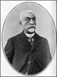
- RENAUD
- FRANCE (see also List of Individuals)\
 30.9.1854 Vesoul/F - 13.5.1921 Paris/F\Joseph Renaud entered Ecole Polytechnique in 1873 and left one year later in the Corps des ingénieurs hydrographes. There he improved the navigability and the management of French ports. During these days, Renaud added to the quality of hydrographical maps as used by the marine and the commercial fleet. He was sent to Indo-China in 1879 to map the Gulf of Tonkin. During military actions in the gulf thousands of small islands were mapped. Back in France in 1894, Renaud was asked to survey the roadstead of Dunkerque, because sand movements had altered the sea ground within a short time. Renaud not only improved the accuracy but also the instrumentation used for such missions during his observations.\Hydrographical maps are an important basis for modifications of naval structures. The public works administration initiated a special report Recherches sur le régime des côtes in which Renaud played a major role. He demonstrated engineering qualities already during his stay in Cochinchina when being asked to define a navigation tour through the swampy Mekong Delta. During low water, navigation had come to almost a standstill and Renaud realized that dretching was much too expensive and certainly not durable. He proposed to use tidal waters running up the river; during their return to the sea they would wash the river bed, indeed a delicate task. In his 1894 report Renaud proposed to connect the port of Haiphong with the gulf by an inland canal. Later, Renaud applied his knowledge to ports on the Atlantic Ocean and contributed to better harbor management and reduced maintenance for their access. He was appointed director of the hydrographical service in 1913 and a Member of Académie des Sciences, Paris.\Favé, L. (1922). Joseph Renaud. Annuaire Bureau des Longitudes: D1-D18. PRenaud, J. (1883). Rapport sur le levé des côtes du Tonkin septentrional. Annales Hydrographiques Série 2 5: 1-12.Renaud, J. (1894). Le port d'Haiphong accessible aux grands navires. Publication 7. Union coloniale française: Paris.Renaud, J., Mion, M. (1914). Dispositions générales relatives aux cartes et plans de l'hydrographie française. Imprimerie Nationale: Paris.Renaud, J. (1918). La carte marine internationale. Imprimerie Nationale: Paris.Rollet de L'Isle, M., Renaud, J. (1886). Instructions nautiques relatives à la navigation dans les chenaux intérieurs de la Côte du Tonkin septentrional. Marine et Colonies, Service Hydrographique Notice 15. Imprimerie Nationale: Paris.
Hydraulicians in Europe 1800-2000 . 2013.
